Description
Geographic Information Systems (GIS) play a crucial role in precision farming by providing spatial data analysis and mapping capabilities that help farmers make informed decisions. Here’s an overview of GIS applications in precision farming:
Key Applications of GIS in Precision Farming
- Soil Mapping and Analysis
- Soil Sampling: Create detailed maps showing soil properties such as pH, nutrient levels, and texture. This helps in identifying variations within a field and managing them accordingly.
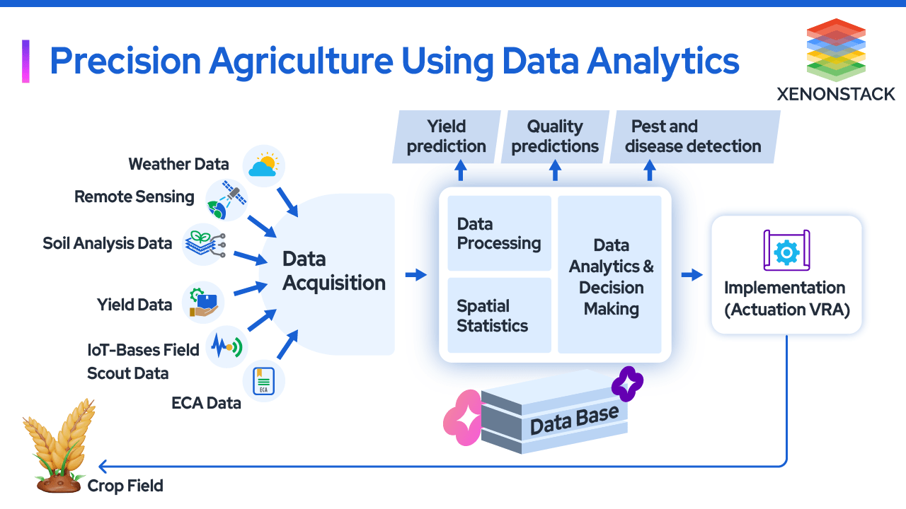
- Variable Rate Technology (VRT): Use soil maps to apply inputs like fertilizers and lime variably across the field, ensuring each area gets the appropriate amount.
- Crop Monitoring and Management
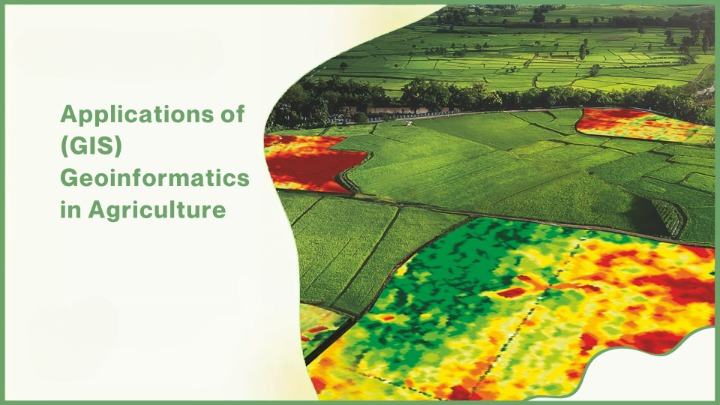
- Vegetation Indices: Utilize satellite imagery and drone data to calculate indices like NDVI (Normalized Difference Vegetation Index) for monitoring crop health and vigor.
- Growth Stage Mapping: Track the growth stages of crops across different areas of the field to optimize management practices such as irrigation, fertilization, and pest control.
- Field Zoning
- Management Zones: Divide fields into different management zones based on soil properties, crop performance, and other factors to apply site-specific management practices.
- Yield Mapping: Analyze yield data collected during harvest to identify high and low-yielding areas, helping to refine management zones for future seasons.
- Irrigation Management
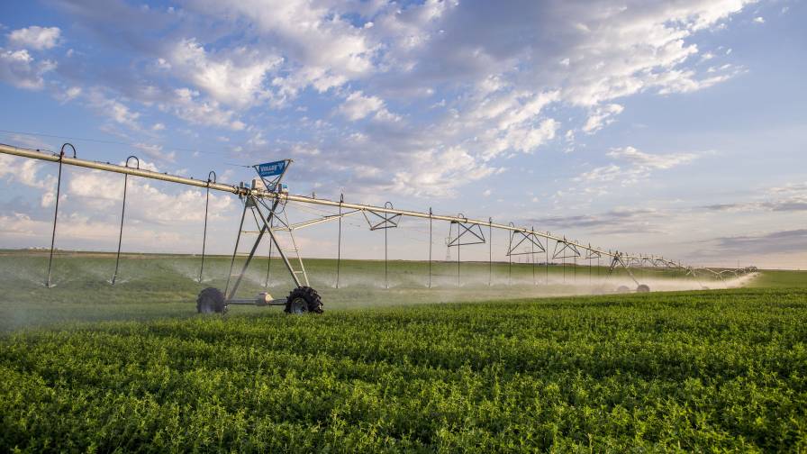
- Water Use Efficiency: Map soil moisture levels and use this data to optimize irrigation schedules, ensuring water is applied where it is most needed.
- Irrigation Zoning: Create irrigation zones based on soil type, crop needs, and topography to apply water more efficiently.
- Pest and Disease Management
- Risk Mapping: Identify and map areas with higher risks of pest infestations or disease outbreaks based on historical data and environmental conditions.
- Targeted Treatments: Use GIS data to apply pesticides and fungicides only in areas where they are needed, reducing chemical use and costs.
- Climate and Weather Analysis
- Weather Data Integration: Incorporate weather data such as rainfall, temperature, and humidity into GIS to predict crop performance and manage risks.
- Climate Impact Assessment: Analyze the impact of climate variability on crop yields and adapt management practices accordingly.
- Resource Management
- Land Use Planning: Plan the optimal use of land resources by analyzing spatial data on soil quality, topography, and existing vegetation.
- Water Resource Management: Manage water resources more effectively by mapping water sources, usage patterns, and potential conservation areas.
Benefits of GIS in Precision Farming
- Increased Efficiency:
- Resource Optimization: Apply inputs such as water, fertilizers, and pesticides more efficiently, reducing waste and costs.
- Labor Savings: Automate data collection and analysis processes, freeing up time for other tasks.
- Enhanced Productivity:
- Yield Improvement: Use precise data to make informed decisions that can lead to higher crop yields.
- Problem Identification: Quickly identify and address issues such as nutrient deficiencies, pest infestations, and irrigation problems.
- Sustainability:
- Environmental Protection: Reduce the environmental impact of farming by minimizing the use of chemicals and conserving water.
- Soil Health: Maintain and improve soil health through targeted management practices.
- Data-Driven Decision Making:
- Comprehensive Analysis: Integrate various data sources (e.g., soil, weather, crop health) for a holistic view of field conditions.
- Predictive Analytics: Use historical data and trends to predict future conditions and plan accordingly.


Izuchukwu –
The practical advice and actionable insights from this digital service have been instrumental in optimizing our farm operations. We’ve used GIS data to create precise planting maps, monitor crop performance, and manage field variability effectively. The user-friendly interface and ongoing support have made it easy to navigate and implement GIS solutions on our farm. It’s been a game-changer for our efficiency and profitability.
Olaide –
This digital service not only enhances productivity through GIS applications but also promotes sustainable farming practices. The emphasis on precision agriculture, soil health, and water management resonates with our commitment to environmental stewardship. The personalized recommendations and real-time monitoring capabilities have been invaluable in achieving our sustainability goals. Highly recommend for farmers seeking to integrate advanced technology with sustainable agriculture practices.
Tabitha –
I’m impressed with the educational value and practical applications covered in this digital service. The explanations of GIS technology, remote sensing techniques, and spatial analysis were clear and informative. The interactive maps and case studies helped us visualize and analyze farm data with precision. It’s empowered us to make informed decisions that enhance productivity and sustainability on our farm.
Sulaimon –
This digital service on GIS applications in precision farming has revolutionized how we manage our farm. The integration of spatial data and mapping tools has provided us with detailed insights into soil variability, crop health, and resource allocation. We’ve optimized planting decisions, improved yield predictions, and minimized environmental impact. It’s an invaluable tool for any farmer looking to harness technology for efficient and sustainable agriculture.